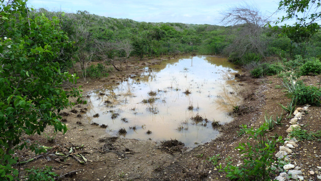
Dam after rain. Photographer Harry Verstappen
The design research Thirsty City РCuraçao project has taught me a lot about the historical fresh water (resource management) system but one thing definitely stands out.
Small island water systems
Small island insular water systems are fundamentally different from water systems in larger land masses. Small islands lack permanent fresh water bodies and ground water resources are limited. Fresh water bodies like lakes, ponds and intermittent streams can be absent, or at least invisible on the land surface for long periods of time only appearing after sufficient precipitation.
Importance of ephemeral streams
We may forget that in many regions, particularly those with an arid climate, water does not manifest itself permanently above the soil surface. There are three types of streams to distinguish:
1) Perennial or year round water streams
2) Intermittent streams will appear seasonally and/or during hight tide / high water tables.
3) Ephemeral streams will only appear after significant amounts of rain. In some areas they will only appear once in so many years depending on regional rain pattern.
While sometimes only appearing for a short period of time the importance of ephemeral streams  for insular fresh water resource management and ecology can not be overstated. Known as ghuts, guts or gullies in the Caribbean and rooien in the (former) Dutch Caribbean islands they were vital for the horticultural practices and livelihoods in general of the native communities. Due to their fleeting nature and lack of know how the importance of these streams was not recognised by the colonial rulers, while the marginalised and often decimated native communities with knowledge and skills were cut off from their lands and water resources. Our research in Curaçao shows that up until today the stream beds of rooi-systems are often neglected or disturbed during urbanisation and / or land use changes. This development has resulted in significant reduced water retaining capacity and increased flood risk during heavy rain. Because of their importance the integration of rooi-systems has become central to our heritage and nature based planning strategy.
If you are interested in the importance of intermittent streams read Freshwater resources in the insular Caribbean : an environmental perspective by Tamara Heartsill Scalley (2012).
The maps drawn by cartographer J.V.D. Werbata between 1911-1915 show the delicate networks of rooien on the Dutch Caribbean islands for the first time. If you want to know more about these maps and their origin story please read: Werbata The Werbata Jonkheer Maps: The first topographic maps of the Netherlands Antilles, 1911-1915, Caert Thresoor, 24, 2005 nr. 1 by Van Der Krogt, P., (2005).
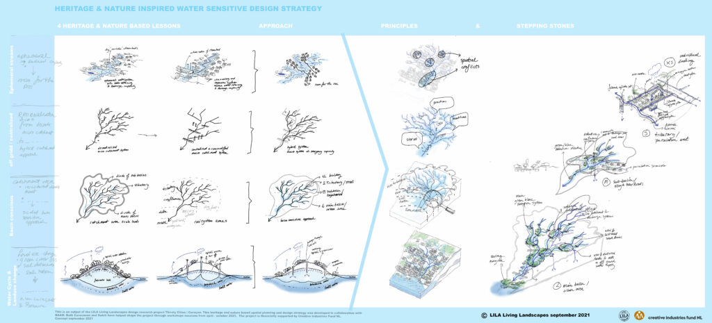
Heritage & nature based spatial planning strategy for Curaçao
The integration of rooi-systems into the spatial planning to adapt to climate change, increase the water retaining capacity and support the local ecosystems the rooi-system has become central to our heritage and nature based planning strategy.

Water inclusive heritage and nature based spatial planning design strateg
©Suzanne Loen / LILA Living Landscapes
Published 21 Oktober 2022
NL Samenvatting:
Juist op kleine Caribische eilandsen als Curaçao verergert de klimaatcrisis de al bestaande paradox van lange perioden van droogte en onregelmatige perioden van extreme regenval en overstromingen in het regen- en orkanenseizoen. Een historisch stelsel van rooien- (vluchtige waterstromen) en dammen, dat door verstedelijking in verdrukking is geraakt, kan bijdragen aan de veerkracht van de water- en groensystemen van het eiland.
This project is executed in collaboration with Claudia Kraan from NAAM (National Archeological Anthropological Memory Management Curaçao) and financially supported by Creative Industries Fund NL.
![]()