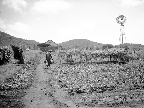
The last and only Sint Eustatius farmer told Dutch Newspaper Trouw in februari 2019 that he could supply the whole Island with fresh vegetables if he could store rainwater underground. Interestingly Sint Eustatius used to store a lot of it’s rainwater in cisterns. Unfortunately this knowledge and heritage has been largely forgotten. So it is high time to shed some light on the subject.
Drinking water and rainwater harvesting heritage
Rainfall varies greatly in the islands of the (former) Dutch Caribbean. Due to the tropical Monsoon on the ‘bovenwindse eilanden’ rainwater cisterns or ‘waterkelders’, ‘waterbakken’ and ‘regenbakken’ or ‘regenputten’ can be found scattered around the islands of Sint Maarten, Saba and Sint Eustatius. Aruba, Bonaire and Curacao (ABC islands) are semi arid with dry spells but may experience heavy rainfall during hurricane seasons, on these islands to a lesser degree smaller ‘regenbakken’ can be found.
The ABC islands used to be covered with dry tropical forests. Human activities from the first Amerindian settlers point to a slash and burn agriculture on a small scale. They used groundwater wells and potholes or waterkuilen to harvest rainwater. Some of these wells have been in use until this day but little is known about this subject and more research needs to be done to understand the pre-colonial freshwater management systems. An invaluable inventory has been made by an inhabitant of Curacao, Mary van Soest, of these so called ‘waterkuilen’, ‘karstputten’ and plantation wells.
Less rainfall due to deforestation
Deforestation on a huge scale in the ABC islands started with the export of brasilwood first by the Spaning and subsequently by the Dutch (from the 17th century) to Europe (for its red textile dye). Introduction of cattle to roam freely prevented the green cover from recovering. Also mangrove forests along the coast were cleared. The last wave of large scale land clearing took place in the 20th century to make way for sisal and aloe vera cultivation. The loss of green cover led to soil erosion and a different hydrological cycle and decreased rainfall. The erratic dry and wet spells are expected to become more frequent and extreme in the region due to climate change.
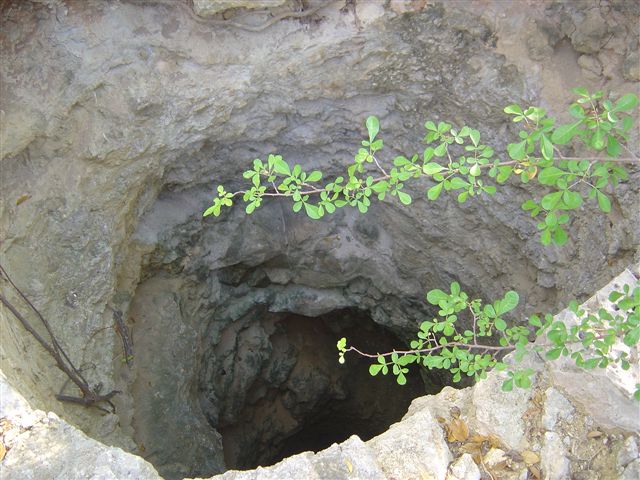
Ancient well or so called ‘karstput’ on the Noordkant of Curacao. (photographer: Mary van Soest | source: MOWIC)
Typologies of drinkwater supply heritage
Several studies and inventories have been done on freshwater resource management systems in the Dutch Caribbean Islands. The Rijksdienst voor Cultureel Erfgoed (RCE) made an inventory of its shared heritage in the Dutch Caribbean in 1995. MOWIC has published the research into Curaçao’s water wells and springs by Mary van Zoest on its website (2016). In 2018 Fred van Keulen wrote his Master thesis on water cisterns of St. Eustatius. Cisterns to store rainwater were built on plantation complexes, near the ports, military forts along the coast, churches and public and governmental buildings. Interestingly, the cisterns are not always built below the main building, as we are accustomed to in the Netherlands, but slightly elevated above ground level. They have more in common with Mediterranean cisterns than with the Dutch waterkelders. As the islands were first colonised by Spain this could be an explanation, but more research needs to be done on that part. Fresh water was a valuable commodity on the islands. So called ‘water plantages’ on Curaçao harvested rainwater and putwater. Selling water to urban residents, business, governing and military bodies and cargo ships.
To summarise the findings of my first exploration of drinking water en rainwater harvesting related heritage on the small island states of the Dutch Caribbean:
- Larger cisterns like waterbakken and waterkelders can be mainly found on Sint Eustatius and to a lesser extend Sint Maarten. These cisterns are dedicated to store rainwater from roofs of plantation mansions and buildings. Because cisterns were expensive and required room they can be mainly found at plantations, around government and military complexes.
- Smaller regenbakken and regenputten were important for domestic use and can be found through out the Dutch Caribbean, also on the semi-arid islands. On Saba rainwater harvesting in so called ‘tanki’s’ is still important for domestic use.
- Surface rainwater catchment reservoirs also called ‘tankis’ or dammen (earthen or stone damms) are open areas to harvest rainwater. They are either natural and/or men made ponds surrounded by low elevated banks to retain the water. They are located in the rooien-basins (aka ghuts, guts or gullies) ephemeral stream-beds that only carry water with sufficient rainfall. Here water was stored above and in the soil (soil storage systems). If possible groundwater could be recharged through the ground or via natural or artificial wells. Larger dams build by landowners were often constructed in the valleys, making use of the natural runoff of rainwater into these catchment areas. These larger and damms were usually situated in or near a grove or orchard on the plantation grounds.
- Micro rainwater catchment system called faha consisting of small earthen damms (no higher then several decimeters to one meter) and small waterkuilen (water holes) can be found in the more irregular and steeped terrains on and around plantations and domeingronden (grounds owned by the Crown). There are strong indications that this system was designed and managed by the enslaved workers and subsequently Afro-Caribbean small holder farmers to secure water supply on their ‘slave gardens’ or so called kostgrondjes (provision grounds). As plantations in the Dutch Caribbean were in fact ‘subsistence’ farms, due to unfavourable soil and water conditions, the rulers and landowners allowed enslaved workers to tend to their kostgrondjes in order to secure fresh food supply. These home and kitchen gardens played an important role in the local and regional inter-island food market. The faha system was believed to be more beneficial for soil and water conservation then the large damm system favoured by the private landowners.
- Large ‘waterputten met pomp‘ with wind powered mills to yield water from deep below the surface. To catch enough wind they were erected on elevated structures and have become modest vertical landmarks
- Ancient wells like karstputten, waterkuilen and plantageputten have been extensively inventoried on Curacao but more research on the subject is needed
©Suzanne Loen / LILA Living Landscapes
Published 10 July, 2019
Updated 19 March, 2021
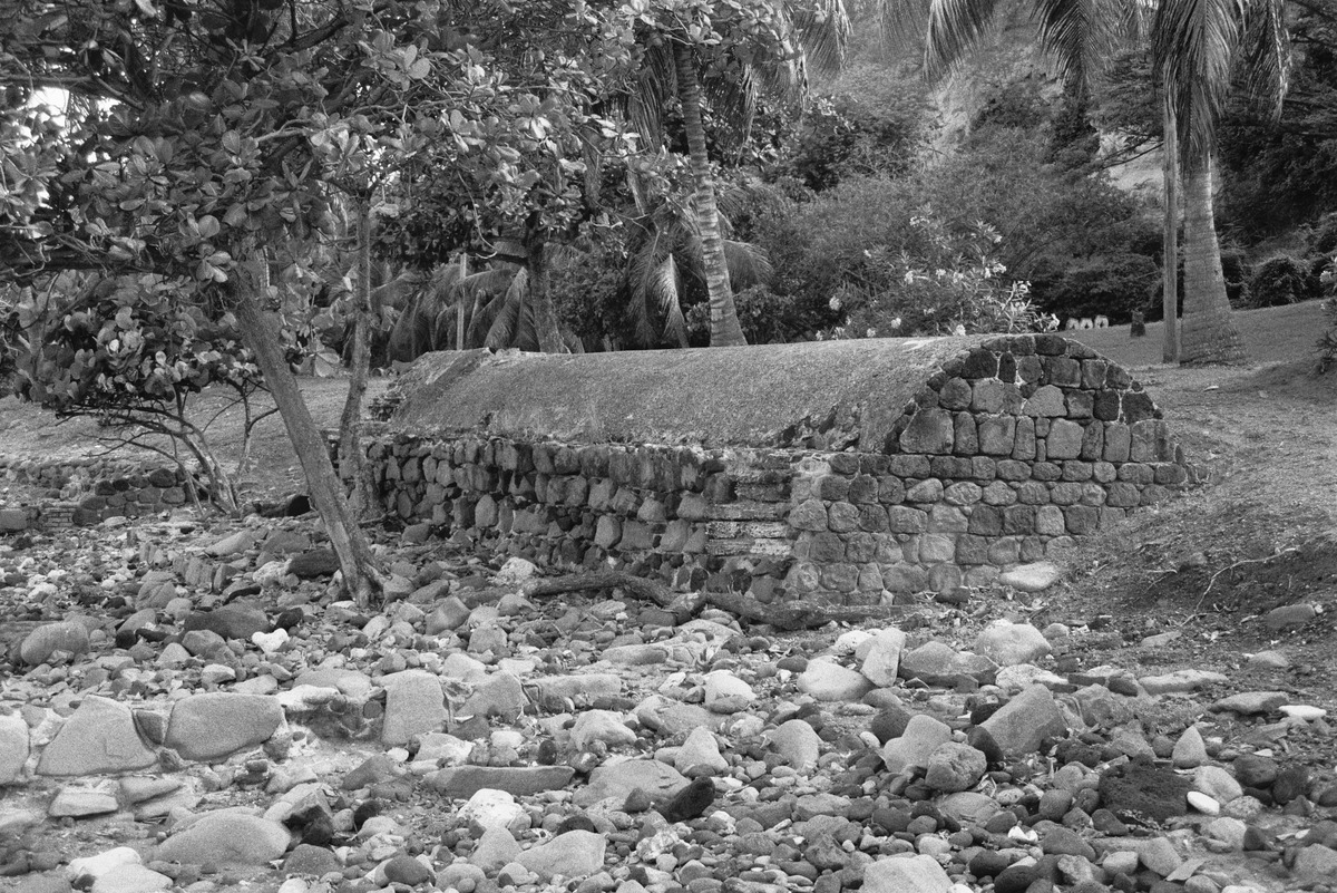
Ruin of a water cistern used to store rainwater in Oranjestad, Sint Eustatius (photographer: Saskia de Kock | source: RCE)
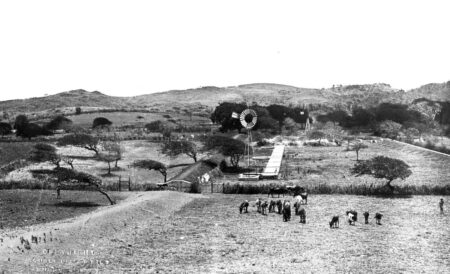
Wind powered wells or waterputten in a ‘tanki’ surrounded by earthen dams to catch rainwater on Plantage Savonet 1890-1920 (Photographer: Soublette et Fils | source: Het Geheugen van Nederland)
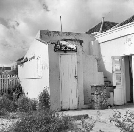
Dwelling built in 1872 with regenbak to harvest rainwater from roofs for domestic use in Bonaire 1995 (photographer: Saskia de Kock | source: RCE)
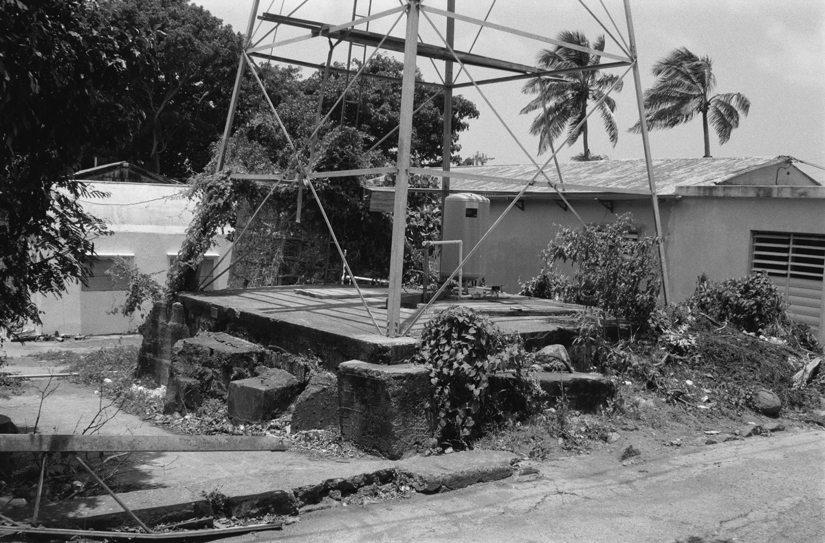
Waterput with wind powered pump on Sint Eustatius in 1995 (photographer: Saskia de Kock | source: RCE)

Waterput or well with wind powered pump in Bonaire 1964 (Photographer: Boy Lawson | source: Het Geheugen van Nederland)
